Stories

The development of these heritage trails are part of a heritage project for Ardmore Tidy Towns, under an EU Horizon project called SECreTour (www.secretourproject.eu). 
 
Ardmore Graveyard Trail can be downloaded >>here<<
Ardmore Village Heritage Trail can be downloaded >>here<<
 
Transcript of radio item recorded by Brian O'Connell and Claire Byrne of Today with Claire Byrne on RTE (22 Aug 2023).
 
Claire Byrne  0:00  
Now in January of last year, an archaeologist and a historian gave their findings on whether there may be mass burials on the grounds of the former mother and baby home in Bessborough in Cork, to date the burial places of over 800 infants who died in the care of a home have not been located. One possibility raised by historian Dr.
The Church of Ireland church and graveyard of St. Andrew’s are in the townland of Ballyroe Lower, in the parish of Kilfinane and in the barony of Coshlea. It is located on Captain’s Lane, south of Upper Main Street (R517) of Kilfinane town.
 
The church and graveyard are dedicated to St. Andrew, one of the twelve main disciples of Jesus Christ. The feast day is 30th November.  Andrew is the patron saint of fishermen and singers.
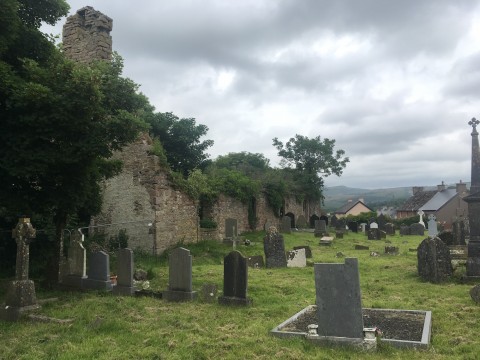
The medieval church ruins and graveyard of Kilfinane are in the townland of Kilfinane, in the parish of Kilfinane and in the barony of Coshlea. It is located on the northeast edge of Kilfinane town, on Castle St., with Kilfinane Castle to the west. 
 
The name Kilfinane in Irish is Cill Fhionain, meaning the church of Fionain (Logainm.ie). The early English records call it Keilfinny or Keilfinane, and imply an earlier form, Coill Finghin, Finghin’s Wood (not cil or ‘church’). It's quite possible that there may have been a Drum-, Coill-, and a Cil Finghin here.
This graveyard is in the townland of Abbey, in the parish of Glenroe- Ballyorgan and in the barony of Coshlea. The townland is a long narrow townland located east of the village of Ballyorgan and west of R517, Kilfinane to Mitchelstown road. Keale townland lies to the east and Ballydonohue to the west. The Keale River forms the southern boundary of the townland and the graveyard overlooks this river valley.
 
The graveyard can be located by taking the road to the east from Ballyorgan village.
This church and graveyard are located in the townland of Ballydonoghue, in the parish of Kilflynn and in the barony of Coshlea. It is located east of Ballyorgan village and south of Kilfinane town. Keale Mountain lies to the north and the River Keale flows south-west of the site. The graveyard can be located by travelling south from Ardpatrick village on the R512. Take the first turn to the left after the turn for Ballyorgan. The site is located several hundred metres up this road on the left and is signposted.
This graveyard lies west of Galbally, a village in southeast County Limerick, on the border with County Tipperary, at the foot of the Galtee Mountains. The Aherlow River flows southeast of the townland and Duntryleague Hill is immediately east. The village of Garryspillane lies to the west with the village of Ballylanders to the south.  
 
Duntryleague graveyard is in the townland of Duntryleague, in the parish of Galbally and in the barony of Coshlea. The townland of Newtown lies to the west of Duntryleague townland and Deerpark townland to the east.
This graveyard lies at the southern end of Galbally, a village in southeast County Limerick, on the border with County Tipperary, at the foot of the Galtee Mountains. The Aherlow River flows immediately south of the village and joins the Suir River near the town of Cahir.  Galbally graveyard is in the townland of Galbally, in the parish of Donaghmore (CHECK) and in the barony of Coshlea. The townland lies roughly halfway between the town of Mitchelstown to the south and the town of Tipperary to the north.  The graveyard is located south of Galbally village square.
This graveyard is in the townland of Killeenoghty, in the parish of Manister  and in the barony of Pubblebrien. The townland lies north-east of the village of Croom and the N20, (Cork to Limerick main route.) Lough Nagirra is located south-east of the site and the townlands of Coologe and Toryhill adjoin this townland to the south.
 
The graveyard can be approached by heading north-east from Croom on the L1408, then take the 4th turn off to the right and then the next right.
This graveyard is in the townland of Adamstown, in the parish of Athneasy and in the barony of Smallcounty. The townland lies northeast of the town of Kilmallock. It is north west of the village of Elton and the R515 and west of the L1508. The village of Bulgaden and the L1413 lie to the west. It can be approached by taking the R515 from Kilmallock and turning north at Elton onto the L1508.  
The townland of Gormanstown lies to the north-west and the townland of Stephanstown lies to the south-east.

Pages