Laois,
Ireland
Coordinates: 53.009000, -7.133000
Summary
Graveyard Code:
LA-OKCK
RMP/Site number:
LA019-003002; LA019-003004
Townland:
Carricksallagh
County:
Description

Project:
Coordinates: 53.009000, -7.133000

| Photo | Grave | Name | Surname |
|---|---|---|---|
 |
LA-OKCK-0325 |
|
|
 |
LA-OKCK-0326 |
|
|
 |
LA-OKCK-0327 |
|
|
 |
LA-OKCK-0328 |
|
|
 |
LA-OKCK-0329 |
|
|
 |
LA-OKCK-0330 |
|
|
 |
LA-OKCK-0331 |
|
|
 |
LA-OKCK-0332 |
|
|
 |
LA-OKCK-0333 |
|
|
 |
LA-OKCK-0334 |
|
|
 |
LA-OKCK-0335 | ||
 |
LA-OKCK-0336 |
|
|
 |
LA-OKCK-0337 |
|
|
 |
LA-OKCK-0338 |
|
|
 |
LA-OKCK-0339 |
|
|
 |
LA-OKCK-0340 |
|
|
 |
LA-OKCK-0341 |
|
|
 |
LA-OKCK-0342 |
|
|
 |
LA-OKCK-0343 |
|
|
 |
LA-OKCK-0344 |
|
|
 |
LA-OKCK-0345 |
|
|
 |
LA-OKCK-0346 |
|
|
 |
LA-OKCK-0347 |
|
|
 |
LA-OKCK-0348 |
|
|
 |
LA-OKCK-0349 |
|
|
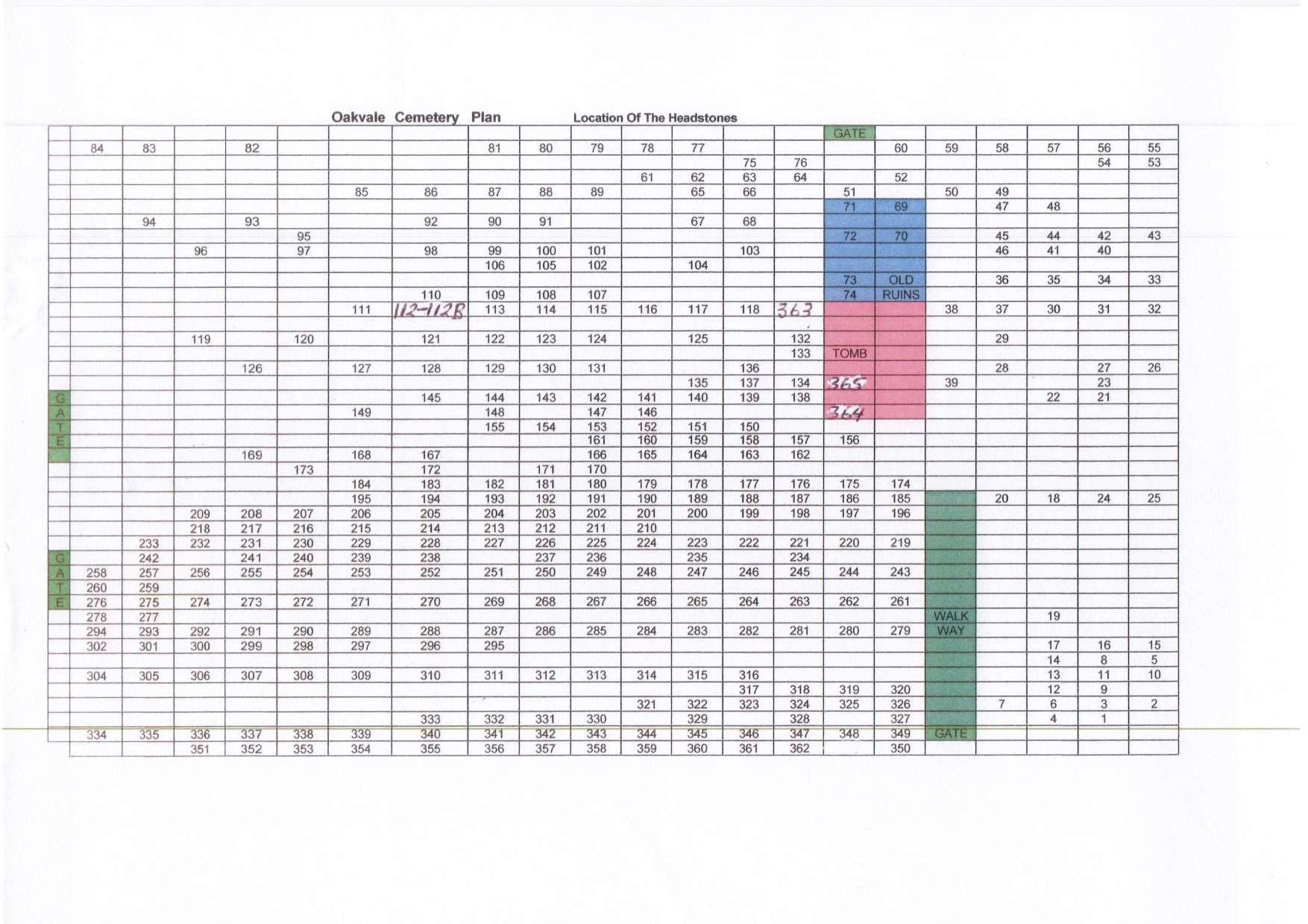
The graveyard is in rural area, surrounded by pasture land, southeast of town of Stradbally.
Graveyard contains ruins of medieval church, associated with St Coleman, as marked on 1841 OS map as 'Oughabal Church (in ruins)'. Graveyard known as 'Oakvale', a probable corruption of 'Oughabal'. Church ruins consist of upstanding walls of chancel, barrel vaulted nave and tower; measure approximately 28m by 10m in plan; ruins of original church were adapted and modified in 19th century.
Graveyard contains 18th to 21st century headstones, in variable condition; some older headstones leaning and worn; some table tombs and graveslabs noted. 18th and 19th century family tombs, vaults and mausoleums built into and around the church ruins, in particular Cosby Family Mausoleum.
Original graveyard has D-shape, with later rectangular annex to south; stone wall boundaries intact with entrance gates along east and west boundaries. A freestanding late 19th century lych gate is located along boundary wall. No paths in older part of graveyard around ruins; tarmac path layout throughout later annex; access from roadside. Ground maintained and grass mown.