 I first encountered a GPS receiver on Professor William O’Brien’s excavations at Ross Island in Killarney, Co. Kerry sometime in the early 1990s. Kevin Barton then of the UCG Applied Geophysics unit and now with Landscape Geophysical Services used a hand held receiver in order to map a surveying traverse through the fantastic Killarney woodland surrounding the excavation area. He described the technique to a befuddled group of sweaty luddite archaeology students, as establishing your position within the Irish National Grid by talking to satellites. I just didn’t believe him and as it turned out it was not so easy to talk to the satellites in a woodland environment. Later in the 90s while working on my MA at UCG I used a more accurate DGPS system to establish survey grid pegs during fieldwork with the ArchaeoGeophysical Imaging Project in Roscommon. Rathcroghan the book written by Waddell, Fenwick and Barton, outlining the results of this project has recently been published (2009). Over the last decade GPS and DGPS systems have become standard tools on large archaeological projects. On the N18 Oranmore to Gort road project for example we used GPS receivers to map our initial phase 1 test trenches and more accurate DGPS systems to provide highly accurate post excavation plans of the excavation areas.
 GPS systems are now commonly used in everyday life most frequently I suppose in Sat Nav kits in cars. The nice lady giving you directions to your destination works from a GPS system. They have a myriad of uses however ranging from remotely driving tractors on large farms to tracking fleets of trucks. GPS chip sets have recently been incorporated into smartphones allowing for a range of location based applications like foursquare and even augmented reality services like Layar. One of the most innovative of these new geolocation resources in an Irish context is the Dublin City Walls App by Medieval Dublin.
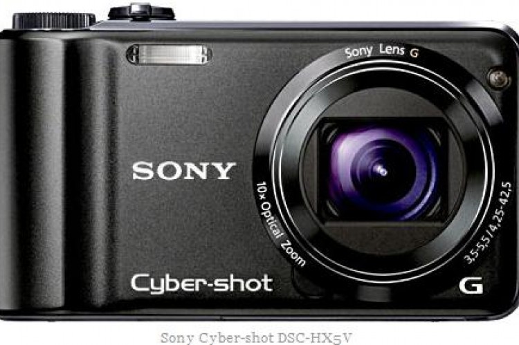
 At our Historic Grave graveyard recording workshops we demonstrate the use of the Sony HX5V in geotagging graveyard memorials. We drill people on warming up the Sony HXV before taking an initial reading to allow for system updates which increase the accuracy of the cameras. In order to further increase the accuracy it is also important to hold the device in a vertical position. We also give a brief background to other GPS systems which can be employed. Maurizio Toscano from Historic Graves has produced a comprehensive guide to GPS systems which forms part of the recording workshop packs given out to all participants on the workshops.


